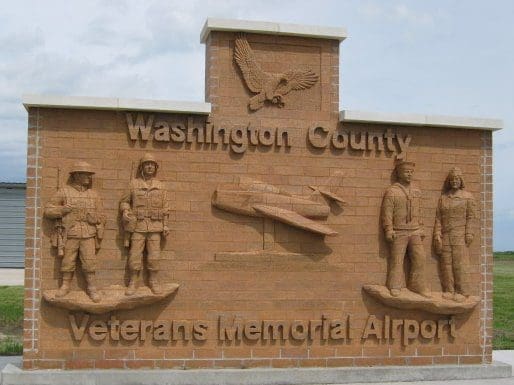
Location
FAA Identifier: K38
Lat/Long:
39-44-06.6000N 097-02-51.3000W
39-44.110000N 097-02.855000W
39.7351667,-97.0475833
(estimated)
Elevation: 1436.5 ft. / 437.8 m (surveyed)
Variation: 06E (1990)
From city: 5 miles S of WASHINGTON, KS
Time zone: UTC -5 (UTC -6 during Standard Time)
Zip code: 66953
Airport Operations
Airport use: Open to the public
Activation date: 01/1980
Control tower: no
ARTCC: KANSAS CITY CENTER
FSS: WICHITA FLIGHT SERVICE STATION
NOTAMs facility: ICT (NOTAM-D service available)
Attendance: UNATNDD
Wind indicator: yes, WIND INDICATOR OTS INDEFLY.
Segmented circle: no
Lights: ACTVT MIRL RWY 17/35 – CTAF.
Beacon: white-green (lighted land airport)
Operates sunset to sunrise.
Airport Communications
CTAF: 122.9
APCH/DEP CTL SVC PRVDD BY KANSAS CITY ARTCC (ZKC) ON FREQS 127.35/257.975 (MANHATTAN RCAG).
Airport Services
Parking: tie-downs
Runway Information
Runway 17/35
| Dimensions: | 3406 x 60 ft. / 1038 x 18 m | ||
| Surface: | concrete, in good condition | ||
| Runway edge lights: | medium intensity | ||
| RUNWAY 17 | RUNWAY 35 | ||
| Latitude: | 39-44.390798N | 39-43.829835N | |
| Longitude: | 097-02.853932W | 097-02.856890W | |
| Elevation: | 1436.5 ft. | 1425.9 ft. | |
| Traffic pattern: | left | left | |
| Runway heading: | 174 magnetic, 180 true | 354 magnetic, 000 true | |
| Displaced threshold: | 220 ft. | no | |
| Markings: | nonprecision, in good condition | nonprecision, in good condition | |
| Touchdown point: | yes, no lights | yes, no lights | |
| Obstructions: | 15 ft. road, 300 ft. from runway, 6:1 slope to clear RWY 17 APPROACH SLOPE 34:1 TO THE DISP THLD. | 68 ft. pline, marked, 1562 ft. from runway, 20:1 slope to clear | |
Airport Ownership and Management
Ownership: Publicly-owned
Owner: WASHINGTON COUNTY
CO CMSNRS, WASH CO COURTHOUSE
WASHINGTON, KS 66968
Phone 785-325-2974
Other Information
Airport Operational Statistics
Aircraft based on the field: 3
Single engine airplanes: 3
Aircraft operations: avg 33/week *
53% local general aviation
47% transient general aviation
* for 12-month period ending 19 September 2018
Additional Remarks
– 24 HR PHONE AVBL FOR PUBLIC USE WITH PHONE CARD.
– FOR CD CTC KANSAS CITY ARTCC AT 913-254-8508.
Instrument Procedures
NOTE: Please procure official charts for flight. FAA instrument procedures published for use from 14 July 2022 at 0901Z to 11 August 2022 at 0900z.
IAPs – Instrument Approach Procedures
RNAV (GPS) RWY 17
RNAV (GPS) RWY 35
NOTE: Special Take-Off Minimums/Departure Procedures apply
Other nearby airports with instrument procedures:
KMYZ – Marysville Municipal Airport (21 nm E)
KCYW – Clay Center Municipal Airport (21 nm S)
KFBY – Fairbury Municipal Airport (27 nm N)
KRPB – Belleville Municipal Airport (29 nm W)
KCNK – Blosser Municipal Airport (30 nm W)

